Height : 593m
Grid Ref : J302262
Google Maps : 54.168477, -6.005944
Prominence : 119m
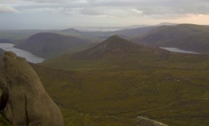
Being quite centrally located in the Mourne Mountains Doan known as Maol Chobha’s Fort has simply stunning views of the surrounding area. A quick clamber will get you on the small grassy top of this odd cone shaped peak from which you will see the surrounding mountains plus Silent Valley and Lough shannagh.
The easiest route is from one of the car parks on the Trassey Road walking the Ulster Way to meet the bottom of the Ott Track which you follow through the col between Slieve Loughshannagh and Carn to a point where you will see Doan rising in the distance. Now you can either make a beeline straight for it, avoiding the drop down to Lough Shannagh and crossing an odd, barren, moon-like terrain to meet it’s gravelly slopes for a quick hike to the top.
Doan Summit Video
