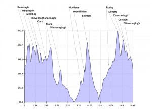
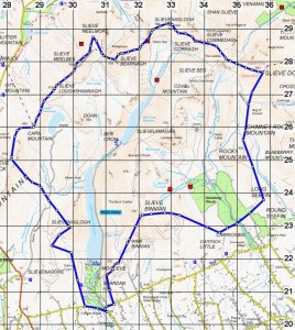
The Mourne Wall was constructed between 1904 and 1922 by the Belfast Water Commissioners to define and enclose the catchment area for the newly constructed Silent Valley Reservoir. The wall is 22 miles long, 1.5m high and 0.8m thick and is constructed entirely of granite from quarries around the Mourne Mountains using classic dry stone wall techniques. It encloses 9,000 acres of mountainous terrain and is designed to keep farm animals away from the reservoirs and rivers that flow into them.
It crosses 15 mountains. Starting at Hares Gap and working anti-clockwise they are:
Slieve Bearnagh (727 m)
Slieve Meelmore (684 m)
Slieve Meelbeg (708 m)
Slieve Loughshannagh (619 m)
Carn Mountain (587 m)
Slieve Muck (674 m)
Slievenaglogh (445 m)
Moolieve (332 m)
Wee Binnian (460 m)
Slieve Binnian (747 m)
Rocky Mountain (525 m)
Slieve Donard (850 m)
Slieve Commedagh (765 m)
Slieve Corragh (691 m)
Slievenaglogh (586 m)
The wall passes the peak of each mountain except Rocky where it skirts the summit. It is also worth noting that there are two Slievenagloghs.
Figures:
Distance : 18-22miles (roughly)
Total Ascent : 2,677m

